|
Bucks Geology GroupBeacon Hill, Ellesborough
Grid reference: SP 836 062.Ordnance Survey map: Aylesbury and Leighton Buzzard Sheet 165.Geological maps: 1:50,000 series Thame sheet 237 and Aylesbury sheet 238.Bucks County Council administration area: Wycombe District.Owned by: Part of Checkers Estate, currently classified as Open access landArea of site: 13 ha.
Access, location and parking: Small car park off the A4010 opposite the church in Ellesborough, or reached via other sites on the Ridgeway public footpath (see under 'Kimble')
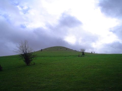
Beacon Hill has been isolated as a steep-sided chalk hill due to the deep incisions made by the dry valleys either side (to the east and to the west, which are known as Great Kimble Warren, Little Kimble Warren and Ellesborough Warren). Immediately north is the escarpment with panoramic views over the clay vale. The 'bumps' of the mid-vale ridge can also be seen on a clear day. Views westwards also shows the characteristic profile of the scarp slope as the outline of Wain Hill at Bledlow can be seen.The underlying geology controls the profile of the hill at this point and this can be seen from the walk to the hill. The Chalk underlying the church at Ellesborough consists of the West Melbury Marly Formation and Zig Zag Formation (undifferentiated here). Walking from the church up Beacon Hill, the break of slope after the first field is formed by the Melbourne Rock and the steep incline of Beacon Hill itself is due to the harder Holywell Nodular Chalk Formation and New Pit Chalk Formation (again undifferentiated here).
Slope processes are not very obvious, but sections where horseshoe scars occur due to sudden failure of the slope deposits can be seen and some areas of soil creep can be found.
|