|
Bucks Geology GroupKimble and the Ridgeway Path
Grid reference: SP 825 058 (Great Kimble); SP 848 068 (Coombe Hill); SP 826 065 (All Saints Church, Little Kimble).Ordnance Survey map: Aylesbury and Leighton Buzzard Sheet 165.Geological maps: 1:50,000 series Thame sheet 237 and Aylesbury sheet 238.Bucks County Council administration area: Wycombe District.Owned by: Various.Area of site: 13 ha.
Access, location and parking: Start at Great Kimble parking in the layby on the A4010 between Princes Risborough and Aylesbury. Coombe Hill is about 5 km along the footpath network, passing Beacon Hill on the way (see under 'Beacon Hill, Ellesborough')
Interest Summary: Stunning scenery over Chalk hills, scarp and vale scenery with Chalk grassland vegetation and woodland.
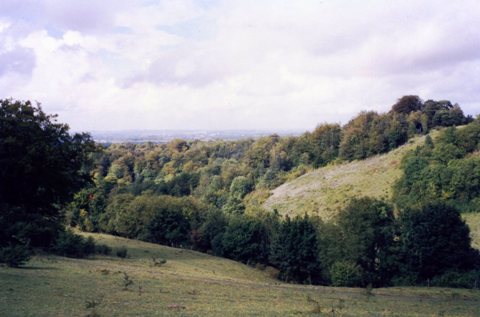
Cross-section from Aylesbury to Coombe Hill showing the rocks beneath the surface that create the scarp and vale landscape. Note how the Upper Icknield Way is on Chalk and hence is better drained in winter than the lower path which is sited on clay. There are many points on this walk where the path lays across or close to dry valleys (see the photograph below). These features dissect the landscape and form the beautiful rounded hills and valleys of the Chilterns. However, they are a relatively young feature - forming from around half a million years ago during the cold phases of the ice age.
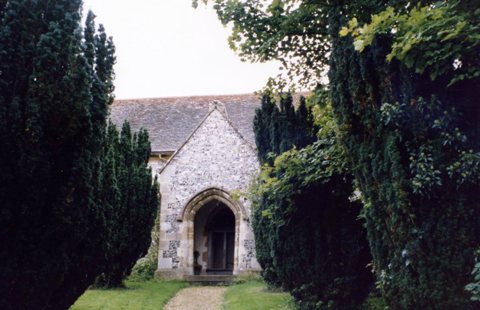
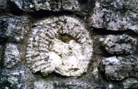
Dry valley on the Ridgeway Path near Kimble Where the Ridgeway crosses the Icknield Way (close to Pulpit Hill) the deeply worn groove of the ancient footpath is very obvious. Here, thousands of years of wear and tear have left their mark as a deep depression, a result of people, animals and carts, of which many were dragging logs from the well-wooded slopes to villages laying at the edge of the escarpment in the vale. The flora is typically chalk downland and is maintained by grazing. However, there is a sudden and distinct change at the top of Coombe Hill where the area of broom, heather and gorse are evidence for a more acidic soil. This is a good example of how biology can help geologists determine geological boundaries. Where these acid-loving plants suddenly appear, is the area that is underlain by Clay-with-flints. Clay-with-flints is not always acid in character, it can sometimes be neutral or slightly alkaline. All Saints Church, Little Kimble. This XIII century church (below) is just off the A4010, with its gate in the Ellesborough Road (walked to from the parking described above). It contains some wonderful medieval paintings and tiles. It also contains a Norman font, no doubt re-used from the earlier Norman site upon which this church was built. The wall around the church is built from local sarsen stone (the sandy Denner Hill type), topped by flint blocks. The flint was probably obtained from local pits dug into the Clay-with-flints, as there is an abundant source on the hill tops all around this site. A nice decorative touch is the large ammonite laid into the wall near the gate (below).
All Saints Church, Little Kimble built incorporating some of the local stone: sarsen, flint, Chalk Rock and local Portland Limestone (browner and shelly), with corner blocks composed of Portland Limestone from Dorset (newer repairs and a paler rock to the local variety). The Chalk Rock has a local name of 'Rag' and this freestone no doubt was extracted from the nearby site of Aston Clinton Ragpits (a BBOWT nature reserve at SP 888 108).
Coombe Hill monument - what is the rock? (contact us if you can identify it!)
|


