|

Bucks Geology Group
Northmoor Hill
Grid reference: TQ 034 891.
Ordnance Survey map:
West London Sheet 176.
Geological maps:
1:50,000 series Beaconsfield sheet 255.
Bucks County Council administration area:
South Bucks.
Owned by:
Local Nature Reserve managed by Bucks Countryside Services.
Area of site: ha.
Access, location and parking: The site is adjacent to the aerodrome at Denham. From the A40 take the A412
(Watford direction). Turn second left into
Tilehurst Lane, past the Denham golf club and the Northmoor nature reserve car park is on the right
(opposite the aerodrome). There is an ample car park, but with a height restriction so coaches cannot enter. There are picnic tables, but no toilet facilities.
Interest Summary: This is an ideal site showing how geology controls habitats. Although there is only a little geological exposure on this site, there are a number of
clues indicating the changes in the underlying geology.
A circular walk around the reserve will reveal the
following features:
1. Alder woodland over Reading Formation Clays.
Take the central path leaving the car park into the wooded area and walk across the wooden walkway. There is no geological exposure at all in this area, but it is clear from the boggy ground and mud that the walkway is
over a clay. The vegetation in this area is a typical 'wet' flora of alder woodland, sedges, rushes, ferns, yellow archangel, Star of Bethlehem, liverworts, mosses, rotting logs, etc. The clay underlying this flora is part of
the Reading formation (Tertiary in age), although this is not obvious at the moment!
2. Beech-oak 'dry' woodland over Reading Formation Sands
Immediately on stepping off the walkway and onto the slope
there is an abrupt transition from the alder woodland to a more open area with beech, oak, holly, and bracken. The ground is obviously better drained here and sand and gravel can be glimpsed along the worn footpath. This botanical boundary marks a geological boundary - the change from clays to sands within the Reading Formation. However, note that the large oak tree here on the left of the
path is very well developed. The tree must have its root system well into the clay layer, as oaks growing on well-drained sands and gravels are usually
stunted.
3. The stream section
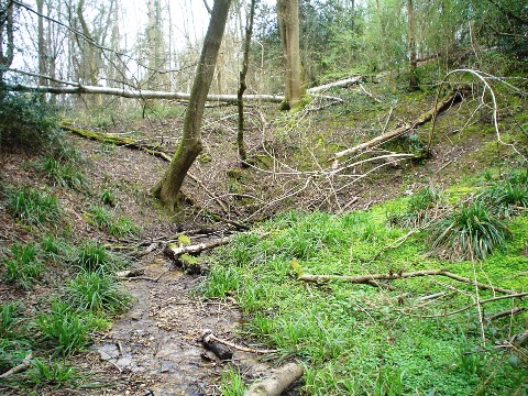
Where the path curves right (about 20 m from the walkway)
take the track to the left. Go through the wooden gate and keep to the left track, descending the steps into the valley. A small stream cuts through the bottom of the vale and flows to your right. As you descend note the sticky clay soil on the banks either side of the path and stream - this is the clay of the wet area earlier.
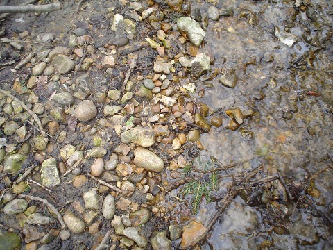
The pebbles in the steam have been washed in or fallen in
from the sands and gravels at the top of the sequence (see below). These are mostly well-rounded and made of flint, with some chert and quartzite. Follow the stream along to the right - it disappears! This is a swallow-hole. Swallow-holes are characteristic features of the Chalk and this indicates that the Chalk lies just beneath the bottom of the valley here. So already, even on this limited
geological exposure, we have a rough stratigraphy for the area.
4. The active swallow-hole
Chalk is susceptible to solution by waters percolating
through the rock. It is particularly susceptible along joint planes - which is where water preferentially flows. Where sets of joint planes intersect the crossing points can enlarge into cavities which, in turn, focus drainage even further at this point. Steams flowing along the surface will drain down into such features, and seemingly disappear.
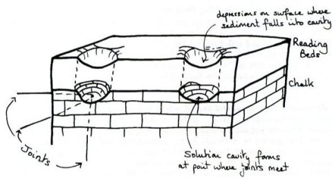
How swallow-holes are formed. These cavities are typically oval or circular in shape and as they often form at intersecting joints, they may be repeated several
times and form in lines (aerial photographs show this up particularly well if the area is open country). The cavities fill up with debris from sediments
overlying the Chalk and/or from debris washed in by the streams draining into them
5. Fossil swallow-hole
Walk up the steps on the other side of the stream - keep
to the lower path, then follow the path down the slope and round to the left to locate the old quarry and the maintained platform viewpoint of the top cliff. At
the face sands and gravels can be seen which are cut into by a pebbly feature which cuts further down into the chalk. This is a fossil swallow-hole - not active today, but a solution feature of the distant past (see photographs
below).
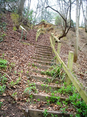
The steps leading to the viewing platform for the fossil swallow hole
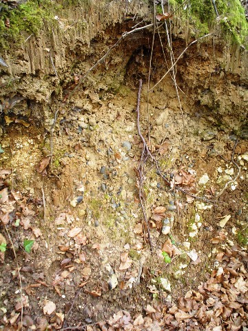
The ancient swallow-hole at Northmoor Hill at the old quarry location. Chalk lines the edge and rounded quartz pebbles lie within it, having been washed into
the hole. The time gap represented by the top of the Chalk and the overlying Reading Formation is about 30 million years. This boundary marks a major change in world
history as, over this time, a massive 75% of the Cretaceous flora and fauna became extinct (including the dinosaurs). This cleared the way for our own evolution.
5. Winter Hill Terrace
gravels and the proto-Thames
Return through the gate and walk straight on, following the
path to the right and up the hill. This joins the main circular path again. In
summer this footpath is full of foxgloves, campions, dog rose, guelder rose,
wood elder and cow parsley - all typical open woodland flora. Stop when the
path comes close to the entrance and a view of the flat open field is possible
(below).
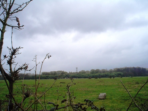
The braid plain of an ancient river system half a million years old.
Although this flat landscape was chosen for the aerodrome
next door, it is not man-made, but it is a natural feature. The large open plain was the result of a massive braided river system. The sands and gravels deposited in this river are known as the Winter Hill terrace, deposited around
half a million years ago from glacier melt waters. Braided rivers occur when torrential flow alternates with a dramatic lowering of flow rates.
Taking all these sediments into account and remembering the order in which they were seen, i.e. what lay on top of what, the geological sequence can now be drawn as below:
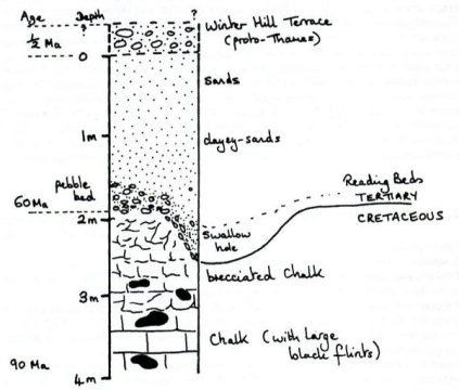
The geological section as deduced by a walk around Northmoor Hill.
|


