|

Bucks Geology Group
Haversham Mill River & Stony Stratford Nature Reserve
1. Haversham Mill River
Grid reference: SP 839 435 for Haversham Mill River.
Ordnance Survey map:
Northampton and Milton Keynes Sheet 152.
Geological maps:
1:50,000 series Bedford sheet 203.
Bucks County Council administration area:
Milton Keynes.
Owned by:
Various
Area of site: ha.
Access, location and parking: Haversham-cum-Little Linford, via the Swan's Way at Mill Farm.
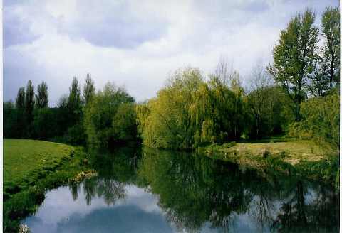
Interest Summary: This is a pretty site which offers a glimpse of the Jurassic (Liassic) rocks as well as river processes with a meander and river terraces all highly visible. This is the only current exposure (in this area) of the oldest rocks in Buckinghamshire - the Upper Lias mudstones and limestones. However, there is some exposure further north in the county (in the Olney area and this rock can be seen in the local buildings there and is used in many gravestones throughout the County).

Although the section is degraded the layers of muds, marls
and thin limestone bands can just be seen in the banks of the meander. These are mid- to pale-grey clays and pale-grey limestones. Fossils are present in the form of broken shells (various bivalves as well as some trace fossils including burrows. Ammonites have been found in these rocks in the past). Access to the rocks is not easy, unless water levels are very low. Therefore, it is not recommended that visitors attempt to sample the rock layers due to the potential of falling in the river.

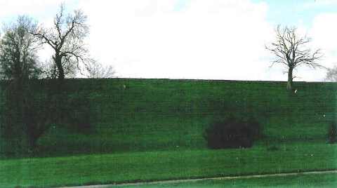
Slope instability is very noticeable within the 1st Terrace and above. In addition, soil creep, slumping and rotational slip are all visible at this site.
2. Stony Stratford Nature Reserve
Grid reference: SP 790 410 for Ouse Valley Park.
Ordnance Survey map:
Northampton and Milton Keynes Sheet 152.
Geological maps:
1:50,000 series Towcester sheet 202.
Bucks County Council administration area:
Milton Keynes.
Owned by:
The Park Trust Milton Keynes.
Area of site: ha.
Access, location and parking: Stony Stratford is part of the Ouse Valley Park, parking lies off Watling Street (A5) in Stony Stratford.
Interest Summary: The Ouse Valley Park lies on the floodplain of the Great River Ouse. This is a meandering river typical of many in southern England and could be used as an educational area for river processes. The nearby balancing lakes add to this story by reflecting on how we manage water supplies and cope with a sudden high rainfall in an urbanized area. There is little geological exposure but river and flood plains provide the main areas of study.
Stony Stratford buildings are a good way to see some of the underlying geology - the Blisworth Limestone and lesser amounts of Cornbrash. Several old buildings in the High Street area for instance show good use of local stone. These can be used to look in detail at the rock characteristics and its sedimentary structures, lithology and fossils - all clearly visible in buildings such as The Moghul Palace (the old church, now an Indian restaurant), the old barn just off the High Street, the Parish Church of St Mary and St Giles (in Church Street) as well as a number of private houses, their garden walls and rockeries.
The following points of interest can be considered on a
visit to both the Haversham Mill River and Stony Stratford sites:
- How rivers 'work' (eroding rocks in some places, depositing sediments in others). Landscape aspects (geomorphology), there are subtle undulations in the landscape either side of the river which have a direct relation to geology some as river terraces and some as harder rocks beneath the surface;
- Geomorphology of the river and its floodplain (use an OS map).
- Meandering rivers - what are they and where do they occur? Low gradients and wide
floodplains are typical of meandering rivers.
- The floodplains and river terraces (1st) - processes at work. The oldest river terraces (ice age) are highest in the landscape; terraces get younger as they approach the lowest (modern) river level
- Biological studies - the link between geology, soils and the plants and animals that live in the area i.e. the different environments in and around the river. Also the re-colonisation following the quarrying activities could also be studied.
- Building Stones: use of the local limestones and as seen in nearby older building.
|


